
Phew, started this post on Wednesday and finally finished it....
We have a link with the charity Map Action at the GA. John Lyon, our Programme Director, ran the London Marathon last year to raise money for the charity.
I contacted Jen Hayward at ESRI UK earlier this week to ask about ESRI involvement in the disaster in terms of their mapping and use of GI. ESRI Inc had produced a map which I blogged about previously, with thanks to Joseph Kerski for the information.
Map Action has a number of volunteers who work for ESRI UK as well as other organisations.
There is a deployment diary on the website.
I will hopefully be providing further updates, and we are working on an additional resource on the GA and ESRI website which refers to the 'mapping' impact of the disaster. Thanks to Ming for keeping me up to date with this too - keep an eye out for future posts on this. Their role is in information management, and supporting the various agencies on the ground.
Kudos also to Ben Hennig who has produced a very interesting map which collates the information on thousands of earthquakes to produce a summary map of thousands of earthquakes going back decades. See the Worldmapper site for more of Ben's work (including a good St. Patrick's map via the Facebook page) and the VIEWS OF THE WORLD blog.

Copyright Ben Hennig of SASI - thanks for permission to use the image
After discussions earlier in the week, ESRI UK have now added an excellent page with a link through to some ways that mapping has been used as part of the response. If you click through some of the links there are more interesting sections on the value of mapping and geographical information.

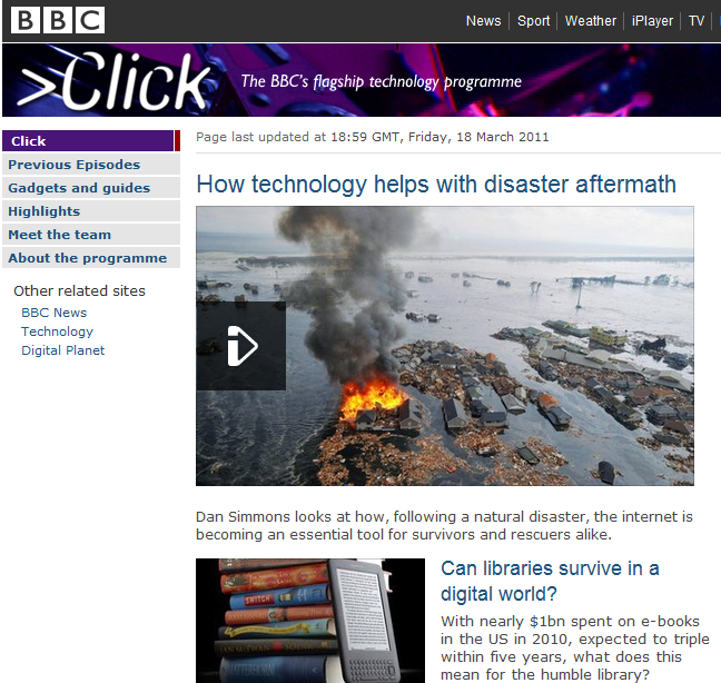
Finally, BBC Click has put up a useful video which connects this all together...
Thanks to Jen Hayward for the tipoff to this once again...

Finally, Channel 4 at Thursday on 9pm has a special programme on the Tsunami...
We have a link with the charity Map Action at the GA. John Lyon, our Programme Director, ran the London Marathon last year to raise money for the charity.
I contacted Jen Hayward at ESRI UK earlier this week to ask about ESRI involvement in the disaster in terms of their mapping and use of GI. ESRI Inc had produced a map which I blogged about previously, with thanks to Joseph Kerski for the information.
Map Action has a number of volunteers who work for ESRI UK as well as other organisations.
There is a deployment diary on the website.
I will hopefully be providing further updates, and we are working on an additional resource on the GA and ESRI website which refers to the 'mapping' impact of the disaster. Thanks to Ming for keeping me up to date with this too - keep an eye out for future posts on this. Their role is in information management, and supporting the various agencies on the ground.
Kudos also to Ben Hennig who has produced a very interesting map which collates the information on thousands of earthquakes to produce a summary map of thousands of earthquakes going back decades. See the Worldmapper site for more of Ben's work (including a good St. Patrick's map via the Facebook page) and the VIEWS OF THE WORLD blog.

Copyright Ben Hennig of SASI - thanks for permission to use the image
After discussions earlier in the week, ESRI UK have now added an excellent page with a link through to some ways that mapping has been used as part of the response. If you click through some of the links there are more interesting sections on the value of mapping and geographical information.

Finally, BBC Click has put up a useful video which connects this all together...
Thanks to Jen Hayward for the tipoff to this once again...
Finally, Channel 4 at Thursday on 9pm has a special programme on the Tsunami...
Comments